Beacon Bound, Part V: Equilibrium

1.jpg

Since Spring 2018 we have followed Nicholas Herrmann as he walked the length of The Ridgeway, an ancient road stretching for eighty-seven miles across chalk downland between Overton Hill and Ivinghoe Beacon, in memory of his grandfather. With this final installment, Nicholas’s journey is completed. You can read all five parts of his walk here.

Tiredness threatens to fell me like a storm-damaged tree. It squats in my skull, crawls down my body: tightening tendons, tying muscles into knots. My back is rigid, my legs are locked, and the ankle injury that started in Uffington has spread to the ball of my foot. I feel semi-petrified, almost stone. At the Ridgeway’s eastern extremity, I step from the car stiffly. I might have forgotten to stretch this morning, or I could have a cold coming on, but maybe this is what seventy-three miles feels like – an accumulated tiredness, the journey catching up with me, the way adding weight. It’s the eve of my thirtieth birthday, and I feel old.

I just have to make it another fourteen miles, today only half: Coombe Hill to the hamlet of Hastoe. We arrive to mud and wind, the night’s rain wiping the world of colour. A short walk along a road and across a field takes us to the lip of the scarp, which we traverse like trapeze artists, balancing high above the Aylesbury Vale. Shortly, we reach the Coombe Hill Monument: erected in memory of the men from Buckinghamshire who died during the Second Boer War. The huge column has on top a torch of gilded flame, with four stone orbs positioned on plinths around its base.

2.jpg

It marks the Edge of the World. This is where, on Sundays, my grandparents would bring the children to run off steam when they lived in nearby Chalfont. I can see why they gave this place such a striking title: sitting on one of the highest spurs of the Chilterns, the monument marks a precipice, transforming the hill into a battlement. With my neck craned, I circle the column that has twice been damaged by lightning since it was first erected in 1904. Before pushing on, I look back the way we’ve come, searching the horizon for the scrawl of the Berkshire Downs. Gradually, the sun pushes through the tangled sky to illuminate the landscape, bringing back words from another Ridgeway memorial: Light after darkness. Hope in light.

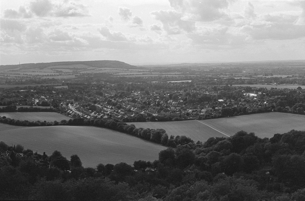
The path eases us on to Bacombe Hill, the last chalk hill before the Wendover Gap, and down into Wendover. We stroll along the main street past the town’s many pubs, resisting the siren song of red lions and white swans, opting instead for take-away pasties to warm our wind-bitten hands. I scold my mouth on the cheese and onion filling, as ahead of us clouds shroud the hillside, Wendover Woods becoming Fangorn Forest in my mind.

3.jpg

Then, through a small park and past the burgeoning Wendover Memorial Community Orchard, planted for the fifty-nine men from the Parish of Wendover who died in the First World War. The River Misbourne joins us for a way – a charming chalk stream that runs clear and shallow. Once more, the path slopes gently upwards and away from the town, the ground yellowing as we trample the last of autumn into the earth. We’ve walked all the way to winter: the trees are skin and bone now, bark and branch. Old chalk pits riddle the hill like ancient craters from a meteor storm. As we approach the summit, a sudden gust of wind eviscerates the clouds, the sun hurling our shadows into the trees and igniting the forest.

4.jpg

We reach the car as the world grows dim, vapour trails skating across the glacial sky. Back at Coombe Hill, we walk out to the Edge of the World, its torch now dark. On a cold bench we drink the last of our coffee, as the lights down in the Vale – Wendover, Oxford, Aylesbury – shiver into life.

*

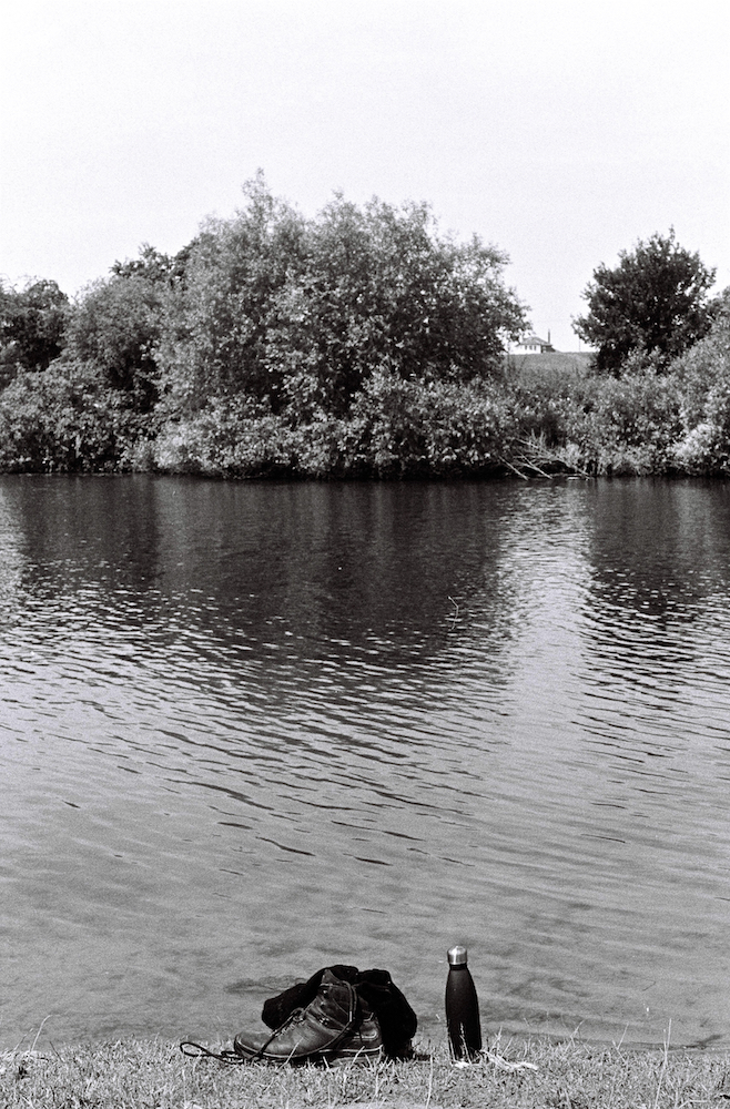
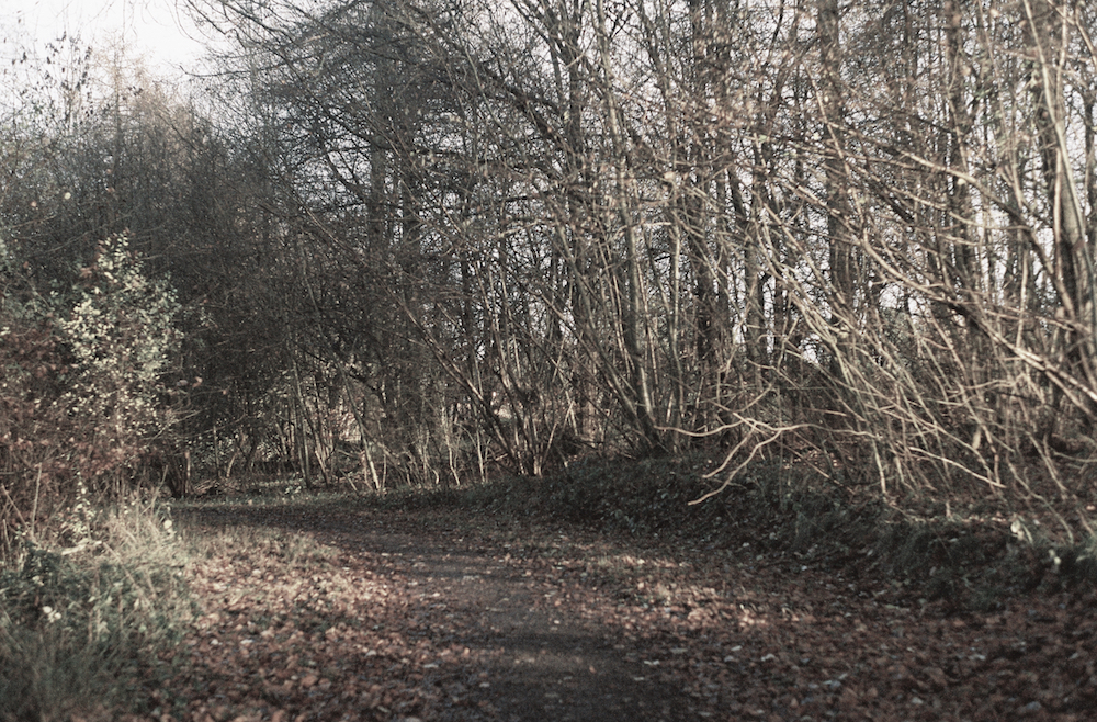
The last day starts with a detour. A mile or so from Hastoe is Hardings Wood, a sixteen-acre patch of ancient forest that Richard Mabey bought in the early 1980s, turning it into a community wood project to clear out inappropriate plantings, and free up regeneration. When Mabey’s depression struck, the land was almost lost, saved at the last minute by a local trust set up by two of his friends. It’s a difficult place to find – at first we drive past the coordinates, expecting a sign or stopping place. After consulting the map, we double back to find the entrance hidden beside a narrow country lane. The wood itself is steep and compact, the path barely visible beneath the brambles. It feels untouched, almost forgotten. I’m with my parents and brother for the final day of our journey, the four of us winding our way to the wood’s centre where we unpack our flasks and have coffee in the trees. The bitter steam mingles with the smell of the forest floor: earthy and warm. It’s quiet, the wood sheltering us from the morning’s chill. Above, beech trees bend in the breeze that cannot reach us.

I don’t know if my grandfather ever came here. I never spoke to him about Richard Mabey – I only discovered the writer’s work this year. But something about Mabey reminds me of John; the two seem like kindred spirits – the same generation, the same interests, the same bewildering knowledge. I know my brother bought him The Cabaret of Plants, and he owned a copy of Flora Britannica that he kept on a shelf guarded by dragons. Perhaps John did make the trip here once, or at least imagined he was here, sipping coffee in the leafy quiet beneath a creaking beech as he flicked through Nature Cure or Home Country.

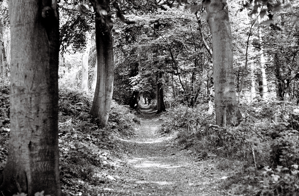
On the Ridgeway, we amble along the tree-lined King Charles Ride – the straight, main path through the woodland of Tring Park. Further on, my mother picks a palmful of rose hips and shows me how to eat them, gently squeezing out the sour orange jam. To me, rose hips aren’t delicacies – they’ll forever be ‘itch bombs’, the stuff my friends and I would put down each other’s backs at school when we weren’t pelting each other with ‘puff balls’, the strange white berries that burst on impact and popped underfoot. I find these beside the path, too: snowberries. My father tells me he used to do the same, weaponising nature in the playground. I picture him tearing around Coombe Hill with a fistful of puff balls, and wonder if John ever did the same. To children, some things are so perfect, they’re obvious. Twenty years ago, the site of rose hips and snowberries would have caused the walk to descend into war, but my brother and I move on, leaving behind the ammunition and continuing into the next field.

5.jpg

We cross over the A41, where from the footbridge I glimpse the Beacon for the first time. My feet feel lighter as we hurry past the train station at Tring – a town famous for a pair of dressed-up fleas at its Natural History Museum, which John loved and took us to see when we were small. We pause on a bench at the foot of a hill to look back at the town. The final outpost before the Beacon.

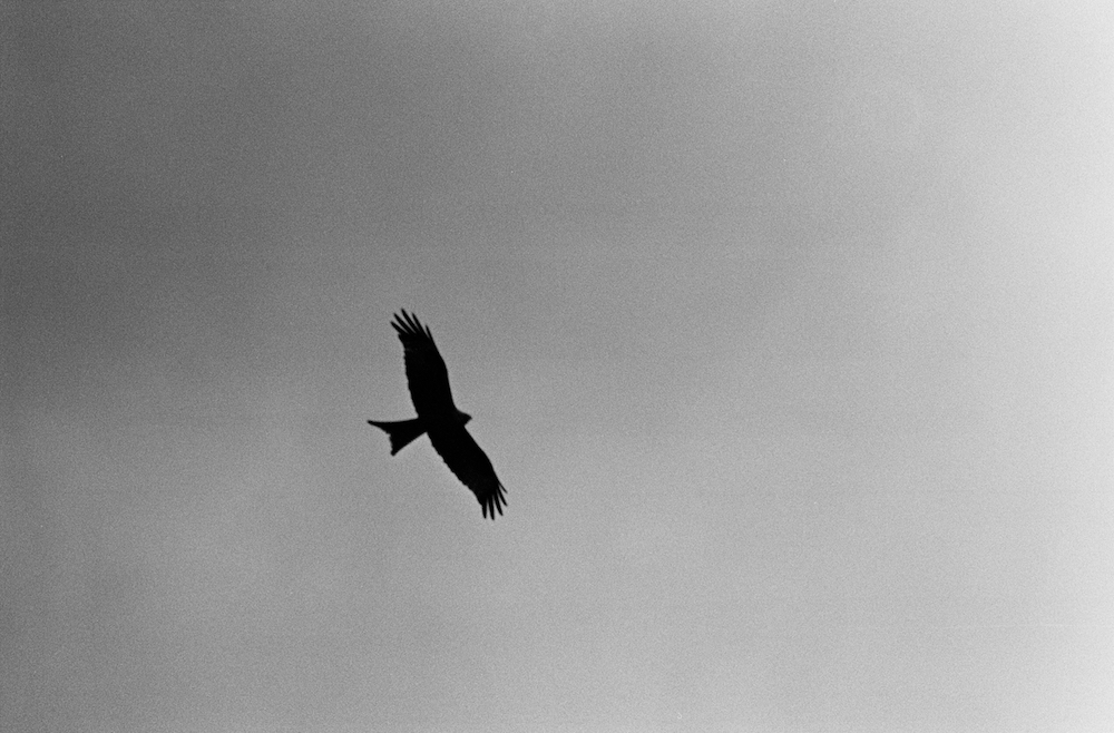
As we start the last ascent, I feel the familiar swell of fatigue. My family must feel it too – the next couple of miles are covered in silence. We crunch over beech masts and climb through a wood, emerging to turbulence. The end is now in sight. We can feel its pull. Our pace quickens: a race against the dying of the light. Beneath us, a disused quarry floods the landscape with green water. As if to urge us on, a red kite sweeps up the hillside and hovers unsteadily overhead, before pitching and rolling away. Our party continues, floundering along the undulating ridge, the distance between us growing, the Beacon bobbing in and out of site like a life raft.

6.jpg

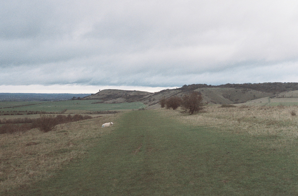
I wait for my father at the bottom of Ivinghoe Beacon, and together we finish the trail. A trig point and a map are waiting at the top. We trace the path with our fingers, recalling the places we’ve passed through. Then we walk to the edge and look back towards Avebury, finding nothing much in the haze. The wind soars up the slope and swirls around us; in the Vale, the clouds lean on Ivinghoe. The forecast promised rain this weekend, but miraculously not a single drop has fallen.

Before heading back, I whistle across the valley, weee-ooh, ee oo ee oo ee oo, and wait for a reply that doesn’t come.

It’s been twelve months and a cycle of seasons since my grandfather died and we unfolded the map. It’s hard to remember a time before the Ridgeway, and I don’t want to. The path has been a lifeline, a conductor, a tether. It’s allowed me to learn about John, understand the rhythms of his mind. Now I’m faced with the end: in front of me the path stops, cut off by a steep slope, the lights of Leighton Buzzard blocking the way ahead. But when I turn to leave, I realise where I’m standing isn’t the end at all. It’s the beginning of the trail – the old road is unfurling in front of me, eighty-seven miles to the west. It’s all yet to come: the beechwoods and berries, Thames and downs, the castles, chalk and sarsens. On the way back to the car, my father and I start discussing where to walk next, making plans for the new year.

When a star dies, the collapse can create an event of such immense gravitational force, matter is compelled from far and wide, and all light is extinguished. That point in space, once brilliant and warm, turns impossibly dark.

But after the collapse, the remnants might form something new. Drifting through space to gather together, finding each other, beginning to grow. And maybe, if the conditions are right, infalling molecules will gather momentum to create light from nothing; a blinding equilibrium to eradicate the dark.

Light after darkness. Hope in light.

The farewell was beautiful.

7.jpg

About the author:
Nicholas Herrmann is a writer and photographer based in Bath. His work has appeared in journals and online, and his writing has been shortlisted for the Bath Novel Award and Janklow and Nesbit Prize. He is a graduate of the Creative Writing MA at Bath Spa University. He is currently working on his first novel. You can find him on Twitter: @NickPSH.

Beacon Bound, Part IV: Momentum

Stripes.jpg

In memory of his grandfather, Nicholas Herrmann walks the length of The Ridgeway: an ancient road stretching for eighty-seven miles across chalk downland, from Overton Hill to Ivinghoe Beacon. We will be following Nicholas’ journey here on the Elsewhere blog over the next couple of months.

As I round the corner a field comes to life, spiralling into the sky. I count twenty before they tornado away, another nine still hunched in the sun. The air is a solid wall of wings. This could be normal for all I know, but it feels like an omen: the universe flexing, a flurry of autumn heralding the end. I lift my camera too late, and through glass watch as the storm of kites blows silently over the hill.

But this is later. The day starts where we left off: by the walls of the neighbourly Church of the Holy Trinity, where we’re offered tea and biscuits before we’ve even begun. A kestrel splashes above the Ridgeway, treading water in the sky. Soon, the path is swallowed by a golf course, so we hunt for waymarks, following a trail of painted acorns. My skin prickles as I pass over dead patches on the manicured lawn – grass singed in the recent heatwave. Today, the conditions for walking are good: cool and overcast. We’ve finally made it to the other side of summer.

Berries.jpg

Like deer, we slip across a road and into the trees, passing through alternating woods and fields of flint. The forested strips are tangled and dim, but autumn’s psychedelia is already spreading. The flash of an arum lily blazes through the late-summer green. Branches droop with dark clumps of elderberries and the shadowy orbs of sloes. Ripening rose hips blush between the leaves. Hawthorns radiate red. At intervals, we pause to gorge ourselves on blackberries, quietly marvelling at their galaxies of flavour: rich, soft, syrupy, like wine. We have entered the treasure season, when countless precious things are offered up by the earth. Happily, I tongue at a seed in my molar as acorns and conkers rain down on the approach to Swyncombe – a village where sheep-eaten trees rise from the field like bearskin hats, the culprits patrolling the grounds around the steeple-less church of St Botolph.

Woods.jpg

The miles start to merge. West of the Thames, the path had defined sections, distinct chapters punctuated by landmarks and sudden topographical changes. There’s less drama in the Chilterns, the path meandering between field and forest, rolling from hamlet to farm. With a lack of milestones, we weave across the landscape in a daze, scattering pheasants as we sleepily kick through crabapples. At a certain point, the path drops and turns sharply northeast. This is where the storm of kites is waiting.

I freeze beneath the boiling sky.

More tree-lined avenues, more fields gilded by the intermittent sun. We pass a yew tree, its berries like bright little bells. All parts of the yew are toxic to humans: the needles, the branches, the bark. Only the fruit can be eaten – the fleshy aril – but not the seed inside, which can cause rapid heart failure due to the lethal amounts of cardiotoxic chemicals called taxine. I remember John worrying me at a young age with this strange fact, on a walk somewhere in the Chilterns. If he were here now, he might also explain that these same compounds can slow and kill cancer cells, and a number of chemotherapy drugs are developed from yew trees. This is a fact I learn later in my research, but I’m sure its one John would have known. This was his area of expertise – for years he worked as a biochemist at a major pharmaceutical company, helping to develop the antibiotic cephalosporin. I reach out. My hand hesitates by the branch. But without John here to reassure me of the biology, I lose my nerve, leaving the ripe berries uneaten.

An immense concrete structure rears out of the landscape, penetrating the hills ahead. We’ve arrived at the Stokenchurch Gap, a forty-seven-metre canyon gouged into the chalk by the M40. The motorway dominates the countryside, drowning out birdsong, polluting the fruit that lines the approach, and crowding the Aston Rowant National Nature Reserve – one of four initial sites chosen for the UK’s 1989 red kite reintroduction programme. Perhaps this explains my earlier encounter: we have found the kite’s heartland, the bird’s birthplace. The road might even serve as some kind of umbilical cord, nurturing them from the cradle with a steady stream of roadkill. I walk quickly through the underpass, aware of the weight thundering overhead. On the other side, a group of horses cowers by a hedge, sonically trapped in the shadow of the road. I wonder if they even notice it anymore, that white noise forever in their skulls.

The roar stalks us for a mile or more. Horse chestnuts lead the way towards Chinnor, already red and shedding to cover old horseshoes in the dry earth. The smell of autumn hits me here: damp and gloomy, brisk and cosy, bringing with it a hundred memories of fires, fireworks, fangs and fake blood. My parents and I sweep through the leaves in silence, the season returning us to our childhoods.

Road.jpg

Once more, clouds gather over the homestretch, mirroring the curves and contours of the downland below. We leave the Ridgeway at a crossroads, turning for the nearby village of Crowell, a leaden sky creeping from the west.  

We’re heading for the edge of the world.

Huge, flooded hollows appear on either side of the path. These are the remains of a former chalk quarry, now the Chinnor Chalk Pit Site of Special Scientific Interest. I catch glimpses behind the trees: white cliffs falling to ice-blue water and wading birds. My father remembers visiting the town as a child when the quarry was still in use, and noticing a layer of white dust over everything. Today, tall wire fences and warning signs stop anyone from entering. It seems like a waste – two perfect lakes cordoned off and hidden from the world. I learn later that before security increased at the site, people would sneak in regularly to enjoy the forbidden waters.

Despite the blockades, it’s a pleasant stretch, warmed by the last of the year’s sun. Dragonflies dart between unearthly plants: spidery teasels and plump, purple buddleia. Soon, we’re crossing over a road to a section of the path bustling with runners and dog walkers, shouts drifting from a nearby football match. The way opens up to the sudden sweep of the Aylesbury Vale, then continues on past tennis courts, hedges trained into unnatural shapes, and wooden fences smeared in creosote.

Lodge Hill.jpg

We’re taken through ash plantations and over storybook hills, where house martins swell above the stubble – one final flight test before heading south. We’ve been hugging the foot of the Chilterns until now, but finally the path rises steeply up Lodge Hill. We stop halfway to catch our breath, and my father tells us about the homemade topographical maps John used to build, reconstructing the Chilterns by cutting and layering sheets of polystyrene. For the rest of the climb, I imagine myself in miniature against a white background, stepping from sheet to sheet.

Finally, we’re in the sky, with vistas reminiscent of the North Wessex Downs, Princes Risborough glittering in the distance as it catches the late-afternoon sun. Small orange butterflies spiral along the ground like fallen leaves, leading us over a railway line to meet up with the Wycombe Road, which rushes towards the edge of town. Here, we veer off, skirting the perimeter through back alleys to another busy road, where vintage cars rumble past on their way to the Kop Hill Climb car show. We’ve made it into Buckinghamshire, our penultimate county.

Panorama.jpg

A giant white cross of unknown origin, carved into the side of Whiteleaf Hill, watches us climb to the bottom of Brush Hill and into the trees. At the top, I startle a drone hovering above the nature reserve like a mechanical kestrel. It lurches in the air, regards me for a moment, then quickly whines away. I turn to get a drone’s-eye view, and I’m struck by a panorama that stretches all the way to the familiar outline of Didcot Power Station squatting in the haze. The distant smudge of the Marlborough Downs lies beyond, where we were clambering half a year and half a world ago. We’re gathering momentum – by the end of the day we’ll only be left with a handful of miles, having travelled through ancient eras and extinct kingdoms, over thousands of years: sarsens, castles, barrows and bunkers, combes, downs, towns and fields, churches, power stations, waterways and motorways, heat, sleet, wind and rain.

Unusually, the path cuts through a pub, squirrelled at the bottom of the scarp. We stop at The Plough to raise an ale to John. Nearby lies the entrance to another nature reserve: the sheltered haven of Grangelands and The Rifle Range, where sheep balance on rippling grassland, and a photographer waits patiently for the golden hour. From here, we follow the bob and roll of the landscape to the Chequers estate. We give the house a wide berth, fearfully sticking to the path as I quietly describe the plot of Rogue Male by Geoffrey Household. In the grounds, a deer tiptoes past a black pole brimming with surveillance cameras.

In the dark of an evening beechwood, I trip over roots, unsteady and aching from tiredness. We finish just before Coombe Hill – a place my father and his siblings would be brought on walks when they were young. They called it The Edge of the World. The name feels appropriate: past this point the Beacon waits. We’ll step off the edge and drift the remaining distance, like ships sailing to the Undying Lands.

The temperature is falling, the light’s bruising blue. There’s something in the air, tightening and retreating. We’ve finished another journey but we haven’t quite arrived. Autumn’s just a border.

Nicholas Herrmann is a writer and photographer based in Bath. His work has appeared in journals and online, and his writing has been shortlisted for the Bath Novel Award and Janklow and Nesbit Prize. He is a graduate of the Creative Writing MA at Bath Spa University. He is currently working on his first novel. You can find him on Twitter: @NickPSH.

Beacon Bound, Part III: Infalling

Monument.jpg

In memory of his grandfather, Nicholas Herrmann walks the length of The Ridgeway: an ancient road stretching for eighty-seven miles across chalk downland, from Overton Hill to Ivinghoe Beacon. We will be following Nicholas’ journey here on the Elsewhere blog over the next couple of months.

There he sleeps, immeasurable: the fire-drake. Somewhere under the earth, in some hill or nameless barrow. His lair is dim and airless, his breast the only glow. His hide is painted in royal reds, scales edged in gold as if gilded with sticky treasures. Coiled around his mass: a tail tipped with a fleur-de-lis. His wings are folded at his sides, bat-like, all skin and sinew. Horns peek from a fog of smoke that spreads with every breath. Claws, blood-muddied, dig into countless piles of precious things.

He could rise at any moment and burn the world away.

*

The Ridgeway smells of dead grass and chapped earth. The fields creak with crickets, and Cabbage Whites drift on the breeze like ash. Our bags are heavy on our bare shoulders as we step into summer. We’ve unpacked our raincoats and drybags, filled the space with water and sun cream. It’s already hot as we pass the Memorial of Lord Wantage – a striking column rising from the ridge, proclaiming aphorisms in Latin across the valley: Peace in passing away. Salvation after death. Light after darkness. Hope in light. Somewhere, we cross into Berkshire, my home county. Soon, we’ll be wading into the Thames and resting in the Chilterns’ beechwood shade, but first we must traverse ten miles of parched and dying downland.

A terrifying alchemy has taken place: the ‘precious stone set in the silver sea’ turned to dust.

Haystacks.jpg

They’re calling it a heatwave. In the coming days, The Washington Post will run stories about the all-time records being set around the world: Africa and Japan witnessing their hottest ever temperatures, people dying in Canada, roads and roofs melting across the UK. The Jet Stream has buckled and the Gulf Stream is grinding to a halt, causing surface temperatures to rise. Whole sections of rivers vanish. Wildfires rage in the Arctic Circle. In Scotland, dogs die from lapping blooms of toxic algae. In Ireland and Wales, the drought causes crop marks to appear: outlines of ancient sites and settlements, unknown or long-lost, like marks from a magnifying glass burning through time. It’s Britain’s driest summer since modern records began. The heat is unnatural, the world uncomfortably warm.

On the path, flies cluster and chase, attracted by our gathering sweat. We push through tall, tick-threatening grass, guessing at the names of the wildflowers that colour the verge. I can only identify the obvious ones: cow parsley, buttercups, thistles. A hiker heading for Overton Hill points out others: ragwort, scabius, vetch. Names like ancient ailments.

My father has been clearing out John’s house in Wales, and there have been discussions about what to do with the dragons. They lurk on bookshelves beside Richard Mabey’s Flora Britannica, squat on side tables above leather walking boots. There’s a dragon cast in iron, low and long; one made of plastic, a children’s toy elevated to ornament; one carved into a wooden stamp. The centrepiece is ceramic, hand painted in green and gold, clutching a crystal ball. It was a love born of studying biology and archeology, reading Pratchett and Tolkien. Even the house was part of the collection in a way – a bolt hole in the land of the dragon.

There’s no hiding from the heat. We’re stalked for miles by Didcot’s smoking towers. It’s a strange section of the trail, unremarkable and vast, the antithesis of Uffington, a place busy with history. We pass under the A34, connecting Newbury and Oxford like a steel pin forced through the bone of the land. The roaring underpass provides a few seconds of relief before we’re once again bombarded by UV rays.

After another stretch, the landscape relaxes into a valley, the power station falling out of sight. At the bottom, a little brick bridge arches over a trench of nettles: the skeleton of the Didcot, Newbury and Southampton Railway, opened at the end of the nineteenth century, closed in the 1960s due to lack of traffic. The DN&SR became important in World War Two, when it was used to transport supplies to the coast in preparations for the Normandy landings. Our presence flusters a couple of wood pigeons that blunder into the trees. I lean on the wall and gaze into the green abyss, imagining the wildlife tucked into the weeds, the insects nesting in cracks, the creatures suspended in shadow. I wonder when the A34 will go this way – sink back into nature, burst open and bloom. Return to barbarism.

Wheat.jpg

The buzz of a Cessna interrupts the heavy quiet of the afternoon. The breeze is thick and warm, dragon’s breath blowing in from the barley. Orchids rise from the bank. Heat haze ribbons on every edge. As we trudge the last few miles, the chalk of the Ridgeway glows white-hot, angling the sun at us, cooking us evenly. I squint, chalkblind.

Finally, we find shelter. A wood materialises on the lip of the Goring Gap as we descend the ridge. It’s a sign we’re moving through a new morphology now, that the windy, sweeping stretches of the North Wessex Downs are behind us. It also means we’re reaching the end of our first ancient highway, the Thames marking the start of the Icknield Way. We walk to the edge of Streatley, where a sign tells us we’ve been infalling for forty-one miles – almost half the distance to the Beacon. We see out the day at Aldworth, a village home to medieval giants, a one-thousand-year-old yew, and The Bell – the Platonic Form of a pub, housed in a building from the fifteenth century. We collapse onto rain-warped benches to savour local ciders beneath the falling sun.

*

The temperature rises by one degree.

Our skin a little pinker, we walk the final mile to Streatley. The town feels like a threshold, a red-brick terminal busy with early-risers leaving for the hills. There’s a book exchange in a telephone box, filled mostly with travel authors left by Ridgeway ramblers: Eric Newby, Paul Theroux, Patrick Leigh Fermor. We pass blue plaques announcing the famous feet that have graced the town: Turner did some sketches here, parts of The Wind in the Willows are set in the surrounds.

Signposts ferry us over the Thames, into Goring, and through a system of alleyways and driveways that cut between castles: riverside mansions that block our view of the water. On the map, the path appears to follow the river closely, but in reality we’re funnelled between eight-foot-high fences, with signs warning: private, keep out, the river doesn’t belong to us.

We emerge from the residential warren into a meadow of yellow wildflowers, ones I now have the power to name: ragwort. A train barrels past on its way to Reading. As we approach the perimeter of the village, church bells ringing the end of Sunday service, I’m put in mind of J.L. Carr’s A Month in the Country. This approach through no man’s land feels foreign, like we’re strolling into the early 1900s – the meadow hasn’t been cultivated, built upon, or swallowed up by Goring. It feels rare to find such a clear delineation, a place not being put to use.

Bridge.jpg

At last, we reach the river, sleepy and wide. Dogs stand in the shallows snapping at phantoms, people wave from paddleboards. We wander alongside, coming to a four-arched Victorian railway bridge I later learn was designed by Isambard Kingdom Brunel. The brickwork shows its age – wrinkled and weathered, bleached by efflorescence, mottled and soiled with moss and soot. Two centuries absorbed in its pores: every storm that’s ever fallen, every boat that’s passed underneath. The bridge crosses the river aslant, the bricks arranged into complex diagonal structures. I linger to photograph an arch, mesmerised by its patterns and tones, the leaves and roots that sprout from the mortar. The years have given the bridge the same plumage as a kite.

Beach.jpg

We follow the water north. It’s hazy, humid, the sun at its zenith. We are desperate to find a place to swim. Soon, we find it: the perfect beach just off the towpath. I take off my hat and shirt, and immediately begin to burn. We wade in. My toes sink into the silt, my blood starts to cool. We stand and listen to the buzz of insects and distant shouts down the river. A laugh from my father – fish are nibbling at his feet. When the sun becomes too much, I bend my knees and launch myself, washing the heat from my skin in an instant. I dive to wipe the sweat from my brow. The relief is profound. My limbs feel apart from me. Like eels, they slip and slither in the shadows of the river. I swim into the middle and float among the dragonflies. I breathe in the fishy smell of willow, weed and water.

Like mudskippers, we climb out awkwardly, finding our feet on the sun-baked bank. I submerge my shirt before putting it on again, to carry the river with me a while. Then we head back into the long grass towards North Stoke.

The path takes us past a ‘Type 22’ pillbox in a riverside garden, its embrasures still narrowed at the Thames as if no one told it the war was over. We enter the graveyard of St. Mary the Virgin, a modest church of flint and beam founded in the eleventh century. Inside, medieval paintings of bible scenes adorn the walls, the figures cartoonish and flat. The thick walls fortify me, my sweat dried by the musty air. It smells subterranean, of a cave or sett, and I am returned to Wayland’s Smithy. My father’s voice reverberates in the empty building – he is reciting a section of his favourite poem:

You are not here to verify,
Instruct yourself, or inform curiosity
Or carry report. You are here to kneel
Where prayer has been valid.

Lines from ‘Little Gidding’, the final part of T.S. Eliot’s Four Quartets. I stand in the nave clutching my notes, Eliot’s words ricocheting around my skull. Outside, the shadow of a kite orbits the churchyard, folding from stone to stone.

Wagtails wash by the old mill, the path growing more secluded on the approach to Crowmarsh, a name perfectly suited to this terrain. We are travelling through edgeland now, a place not quite nature, not yet town: boggy, littered and overgrown. The scent of poplar and lime mix with car fumes that linger above the A4074 – a road that acts as a final boundary before we’re once again climbing into the hills.

Beechwood.jpg

This is where we run out of water. My skin wrings out the last few drops as I snake down narrow, nettle-lined paths that wind between wheat fields belonging to Lonesome Farm. We pause on the edge of our first proper beech forest where the ferns are thick, the birdsong exotic and loud. The topography has shifted: shady, verdant, animate.

Grim’s Ditch, a series of mysterious ancient earthworks we’ve been following for miles, grows deeper as we near Nuffield, like a dried up riverbed from some distant climatic tragedy. A red kite raises the alarm as we emerge from the trees: dragon-like, a lookout on the edge of its kingdom. The Church of the Holy Trinity, practiced in aiding walkers, supplies us with a bench and a tap. We fill our flasks and stomachs, water dripping from our chins. The kite whirls above us in the low light, sounding its battle cry: weee-ooh, ee oo ee oo ee oo.

All the colours of heat.

Nicholas Herrmann is a writer and photographer based in Bath. His work has appeared in journals and online, and his writing has been shortlisted for the Bath Novel Award and Janklow and Nesbit Prize. He is a graduate of the Creative Writing MA at Bath Spa University. He is currently working on his first novel. You can find him on Twitter: @NickPSH.

Beacon Bound, Part II: Remnants

Bunker.jpg

In memory of his grandfather, Nicholas Herrmann walks the length of The Ridgeway: an ancient road stretching for eighty-seven miles across chalk downland, from Overton Hill to Ivinghoe Beacon. We will be following Nicholas’ journey here on the Elsewhere blog over the next couple of months.

‘The farewell was beautiful.’

These are the first words of Trouble With Lichen, John Wyndham’s 1960 novel about an antidote to old age. I’ve brought it with me to read on the journey – twenty miles further to the edge of the North Wessex Downs. John, my grandfather, was a keen reader of science fiction, and we bonded over this shared love in recent years. He had a soft spot for authors from the Golden Age: Asimov, Christopher, Clarke. Wyndham was a favourite, and as I address this gap in my knowledge on the morning of the walk, I think I can see why: the rigorous attention to scientific detail, the careful, complex female characters, the disconcerting ring of truth.

I’m thinking of immortality as we step onto the Ridgeway. The path carries us in a curve around Ogbourne St. George – a place unrecognisable since we were last here. The air is heavy with blossom and birdsong, lambs bleating in a nearby field. Green tangles of cleaver, nettle and fern spill off the banks. Everywhere the trees are fluorescent and full. We’ve left winter behind us, somewhere among the sarsens of Fyefield and Avebury. My father and I pick a couple of the young beech leaves – a food that sustained the partisans of Yugoslavia as they resisted the Germans during the Second World War. My grandfather on my mother’s side was a partisan. This was his relationship to the land: survival. The taste of the leaf is strong but not unpleasant, a grassiness giving way to the tang of green apple.

We cross over the clear waters of the Og. A dozen swifts dart high above the water, feeding, or playing, or simply celebrating their homecoming after a long journey back from Africa. Their movements are sharp and delicate, like paper aeroplanes brought to life. The trail cuts through a thatch of cottages, and over an A-road, until finally the path grows steeper and we’re climbing free from civilisation. Seams of chalk appear in the earth as we ascend onto the ridge, blending with the white of the blackthorn.

It’s good to be on the old road again, so high above the world. As we find our stride, I have to relearn the landscape, vernal now – budding, noisy and bright. Linnets kiss behind clumps of gorse. Larks shout down from the clouds. Rapeseed ignites the fields and fills the air with musk. We even pass through wooded sections this time, where bluebells colour the ground beneath canopies of luminous green.

I walk a few paces with closed eyes and held breath: nothing but nature.

Fallen.jpg

The path takes us north through wheat fields to Liddington Hill. We make a short detour off the path to our second Iron Age hillfort. Liddington Castle feels more compact than the one at Barbury, and more formidable. It looms on the very edge of the downs’ northern escarpment, with dominating views across the valley: the M4 meandering below, Swindon’s hospital and wind farm rendered miniature.

In 1884, Richard Jefferies put the final touches on what would become one of his last works. The nature writer and novelist had been suffering from tuberculosis for years, and was near destitute after paying for a number of unsuccessful surgeries. His life during this period was hellish. Delirious, starving and in constant agony, he could barely sit up to write. Yet somehow, three years before his death, he managed to get his late masterpiece on paper: a post-apocalyptic vision of the aftermath of an unnamed disaster that causes the country to ‘relapse into barbarism.’ In After London, Jefferies poured his love of nature, his knowledge of the countryside, and his suspicion of the city to describe a world reverted to medievalism. ‘It became green everywhere in the first spring, after London ended,’ he writes, ‘so that all the country looked alike.’ Forest once again covers the land. An enormous lake forms in the country’s centre. Where there once was a metropolis, there exists only a vast swamp exuding ‘so fatal a vapour that no animal can endure it.’ London has become a nature-less nightmare: ‘There are no fishes, neither can eels exist in the mud, nor even newts. It is dead.’

Jefferies was born within sight of these hills, in a farmhouse in the hamlet of Coate, now part of Swindon. He wrote extensively about the surrounding area, and would often walk up to Liddington Castle in the heat of summer to lie on the embankments and observe the behaviour of skylarks. Standing here now, on top of ancient earthworks, it’s easy to understand the genesis of Jefferies’ pioneering novel – imagining people alone so long ago, young and unencumbered, looking out at a landscape free from rape fields and power stations. Making my way back to the trail, I wonder if John had a copy of After London in his collection, dog-eared and yellowed, tucked on a bookshelf beside The Day of the Triffids.

Nearby is another fortification, but from a time far more recent. Marauded by multicolours of graffiti and lichen, a concrete bunker squats beneath Liddington Clump, on the hill’s eastern summit. It’s a control bunker from a Second World War ‘Starfish’ site – elaborate systems of light and fire designed with the help of film industry technicians to look like blitzed cities from above, devised after the decimation of Coventry in 1940. This one controlled a simulated Swindon, triggering nighttime blazes to divert the wrath of the Luftwaffe. The bunker demonstrates the Ridgeway’s power and pull – its quiet ability to whisk you between eras, usher you quickly through time.

From here, the path leads us down the hill to join a main road and cross over the M4. It’s a strange stretch, with no clear way for walking, and we flinch as cars speed by. I stop on the overpass and look down at the galloping machines. It’s a shock to the system, but I’m glad the road is part of our journey – it’s one that has run through my life for as long as I can remember. It was one of the first seams, by which everything else was joined. It connects almost all the places I’ve ever lived.

We are obsessed by roads. They have a way of getting under the skin, tunnelling close to the heart. We have a strange capacity to love them – a propensity to personify them, bestow them with mythical qualities. About roads, we sing, and write and reminisce. They represent the torment of our innate desire for freedom.

At last, we’re climbing to the hush of the hills, the trail becoming a level section leading us out of Wiltshire and into Oxfordshire, the second of the Ridgeway’s five counties. New shoots tinge a ploughed field with otherworldly green. Podgy bullfinches crowd the path past Idstone, their plaintive whistles following us from every tree. Above, the sky gathers and threatens to fall, but something holds it at bay. The world is suspended in a paradox of gold and grey, dark clouds hanging over irradiant rape, cowslips, gorse.

Gold.jpg

*

The next day is littered with landmarks. They huddle above Uffington, mystifying. We pass Wayland’s Smithy first, a long barrow nestled in beech and encircled by sarsens. Named by the Saxons around 4,000 years after it was first built, the barrow was believed to have been the home of the eponymous god of metalworking – maker of wings and magic swords. I climb inside. It’s quiet under the earth, the hill dampening the bustle of spring. The chamber smells of mud and root. The previous day’s walk has inflamed a tendon in my ankle, and I find myself communing with age-old powers. Legend has it Wayland reshoes horses tethered here overnight. I beseech the barrow to restore me.

Onwards a while and I’m faltering up another earthwork: the ramparts of Uffington Castle. As always, sheep graze along the embankments, and the wind seeks to bear me aloft. The Iron Age hillfort feels like the highest point so far, towering above the Vale of White Horse, and commanding a 360-degree panorama: the wind turbines of Swindon, the hazy outline of the Cotswolds beyond; patchwork fields leading eastward to Wittenham Clumps and the hyperboloid cooling towers of Didcot Power Station; the Chilterns in the distance.

Lifting my hood against the wind, I descend to one of the country’s most recognisable landmarks, carved into this hillside over 3,000 years ago. Like so many things along the Ridgeway, the purpose of its existence has long been forgotten. From where I’m standing it’s no more than a few abstract lines. But from the villages down in the Vale, these curves become an enormous chalk horse – so vivid and prominent that at the same time a counterfeit Swindon was being built on Liddington Hill, and resistance fighters were eating beech leaves half a world away, the creature had to be concealed with turf and hedge trimmings to prevent it from being seen by enemy aircraft. It lies on its flank across the northern escarpment of the downs, aged and weary.

Horse.jpg

Escarpment. Scarp. These are the scars from wounds inflicted on the land millions of years ago. The chalk that gleams in every gash is made from the shells of coccolithophores – minute plankton that dwelt in the Cretaceous seas once covering Britain. As the African and Eurasian plates collided, a tremendous storm of earthquakes altered sea levels and heaved the strata into high hills and mountains. Gradually, ice, wind and rain whittled these down to their smooth and familiar contours. This same tectonic movement forced into existence the ranges along the Alpide belt – including the Atlas, Alps, Himalayas and Pyrenees – and still continues today. As I stand on the very edge of the escarpment, on the remnants of prehistoric sea creatures, I try to sense the earth shifting beneath me, raising me into the sky.

I turn my back on the horse, the castle and Dragon Hill – the site where Saint George supposedly slew the beast. The weight of this place is almost too much to bear, and it’s a relief to once again feel the road beneath my boots, the home stretch somewhere ahead of me.

We make tracks along the ridge and past the stables of Lambourn: racehorse country. The way is high and open, the view across the Vale following us for miles. Three kites tumble above one of the trig points that dot the landscape, the whiteness of their underwings flashing against the sky. The downy leaves of silverweed glint beneath us. Roman soldiers used this plant to soothe their feet on long marches – I consider stopping to stuff my boots, but the sky is growing ever heavier, a few drops starting to fall. We quicken our pace, heads angled against a northerly wind.

Slowly, we leave Swindon behind, the forests beginning to thicken in the valley below. The next stage will take us out of the Berkshire Downs to the wooded doorstep of the Chilterns. Thirty miles covered, now – a third of the way to the Beacon.

We stumble back to the car windburnt, with cracked lips.

And finally, as we join the M4 heading east, the heavens open.

Nicholas Herrmann is a writer and photographer based in Bath. His work has appeared in journals and online, and his writing has been shortlisted for the Bath Novel Award and Janklow and Nesbit Prize. He is a graduate of the Creative Writing MA at Bath Spa University. He is currently working on his first novel. You can find him on Twitter: @NickPSH.

Beacon Bound, Part I: The Collapse

Kite 1.jpg

In memory of his grandfather, Nicholas Herrmann walks the length of The Ridgeway: an ancient road stretching for eighty-seven miles across chalk downland, from Overton Hill to Ivinghoe Beacon. We will be following Nicholas’ journey here on the Elsewhere blog over the next couple of months.

When a star dies, the collapse creates an event of such immense gravitational force, matter is compelled from far and wide, and all light is extinguished. That point in space, once brilliant and warm, turns impossibly dark.

This is the image I have in my mind on the day my grandfather dies. The family is gathering at the house, and I’m speeding eastward on my way to say goodbye. The twenty-year-old car rattles and shakes, struggling to do seventy, and as I wedge the drooping window with an elbow, I remember from whom the car was inherited.

The red kite signifies the beginning of the Chilterns. Usually, its presence is comforting, telling me I’m close to my childhood home. On the M4, they appear around Newbury, their distinctive shapes patrolling the skies at the limits of some invisible boundary. I see one now, urging me on like a herald, soaring on an updraft as it leads me towards the tragedy.

Several hard hours later, we fill the house with memories. His gentleness, his mischief and decorum, his astounding knowledge of the natural world. The January sun shines a cold light onto dregs of Earl Grey. With energy left only to sit still, my father speaks an idea into the silence: he will walk the length of the Ridgeway – that ancient track that John, my grandfather, loved, and lived beside for much of his life. Eighty-seven miles from Overton Hill in Wiltshire, northeast along the North Wessex Downs and Chiltern Hills, to Buckinghamshire’s Ivinghoe Beacon. Britain’s oldest road.

There is unanimous support for the idea. A plan is quickly formed and agreed upon: my father and I will walk the route in stages, others joining us whenever they are able. We rise to leave. As I pull on my coat, a Post-it catches in the corner of my eye – something destabilising, at once familiar and strange. A small reminder, of something done or undone, written by someone else in my own handwriting. Another inheritance.

*

We start on Good Friday. As we load our packs into the car, a pair of red kites fly out from their nest in a nearby beech tree and circle us. Their call: half whistle, half screech, steady like a kettle on a camping stove. They fly low, their kiln-coloured breasts almost skimming the chimney. We stop and watch in the light rain, able to make out every mark on their speckled chests, every feather on their ashen heads. Red, white, yellow, black: all the colours of heat. Like winged devils they twist their singed wingtips and flick their forked tails. Then they pitch and roll away together over the fields, two embers drifting on the wind.

Kite 2.jpg

Scavengers, survivors, masters of extinction. As they once did in medieval times, kites fill the sky above Reading. At any given time, you can look up and see two or three of these raptors stalking the suburbs. But in the 1930s, after decades of persecution, just one or two pairs remained in the UK. Now, Britain acts as a lifeboat for the species – there are thought to be around 2,700 breeding pairs after a 1989 reintroduction in the Chilterns. And their numbers in Reading are on the rise. A study from 2015 found over four percent of households purposefully leave out meat for the birds, causing hundreds to commute into town each day from the surrounding countryside.

Avebury stone circle lies a mile and a half away from the start of our journey, so we make a stop to remind ourselves of its might and mystery. A crow lands on a megalith, oblivious, or uncaring. I place a palm on a pockmarked, rain-slick stone twice my height, its purpose lost to the ages. We make our way south, circle Silbury Hill – cumbersome and impenetrable – and pass the West Kennet Long Barrow, haunting us from a hilltop. The beginning of the Ridgeway is a car park that sits beside three squat tumuli, too regular on this topography to be given names.

This place undermines time. Prehistory and present congeal like the rain-churned paths orbiting Avebury, a thousand footsteps preserved in mud.

The Ridgeway National Trail was opened in 1973, and is just a section of a five-thousand-year-old route that used to run from the Dorset coast all the way to the Wash in Norfolk. In prehistoric times, the plains and lowlands were heavily forested and covered in undergrowth, making progress near impossible. The chalk provided a way through, drier underfoot, less impeded by vegetation. The trail we know today comprises two different ancient highways stretching across five counties and divided neatly by the Thames – the Ridgeway to the west, the Icknield Way to the east.

Sarsen.jpg

I step over the threshold. The chalk track stretches out in front of me, a steady incline of white on green, clinging to the contours of the Marlborough Downs. Stuck between seasons, the landscape sags under the accumulated weight of the rain, the track transformed to a gritty paste beneath me. To our right, woody tangles of hazel, gorse and hawthorn. To our left, fields curve down to villages and farms safely tucked into the combes below. Everywhere, we pass the sleeping noble dead, their resting places marked by clumps of beech dotted across the undulating landscape.

It’s quiet on the ridge. The weather is deadening, driving wildlife to its shelters. We pass rook nests and badger setts, unreachable and dark. I imagine these creatures in their sanctuaries watching our progress along the hills, as they have done for millennia. A solitary skylark punctures the hush, jostled by the wind. A hare takes flight. I step off the track onto the furrowed edge of a field. Shards of flint mark its perimeter, newly banished by the plough. I am hunting for axeheads and arrowheads, as I was taught to, by John. I slow my pace, using my feet to nudge and lift stones from the soil, hoping to unearth an artefact – coins, pottery, a clay pipe – just as he would while walking these hills.

Sarsen stones – those huge, mystical sandstone blocks used to construct Avebury and Stonehenge – litter our surroundings, increasing in number as we approach Fyefield Down. In this area alone, there are said to be 25,000. They are called the Grey Wethers, resembling sheep from a distance, but to me they just look like stones: inert, lopsided and lichenous, strewn across the hillside by a geological cataclysm. We press on, past four White Park cows sheltering from the easterly wind behind a gorse bush. Charming and ancient, with long, perfect horns, they turn to watch us through barbed wire.

White Park.jpg

Soon, we enter a section flanked on either side by shivering hawthorns, dense vegetation climbing their trunks as if the ground is rising to claim them. I pause in a puddle, confounded. As I consider the trees I become agitated, realising I don’t understand the process taking place. I don’t know if the growth on the trunks is moss, or lichen, or liverwort – if it’s harming the trees, or killing them, or benefitting both sides.

I don’t belong. I am out of place – a vagrant, a product of the city, a non-native species in a foreign land.

What am I doing out here, so exposed, so far away?

This is John’s world, not mine. He had a passion for moss and lichen, collecting them on walks, filing them with labels carefully away in a miniature chest of drawers. The photograph at his memorial is a portrait of John kneeling in a wood somewhere, studying the undergrowth, excited by a find. He would have understood this. He would have been able to explain it to me.

Further along, the track levels out, an alley of breeze-bent trees winding past a dew pond. Above, a kestrel is suspended against the clouds, feathers fanned and tousled. From a great height it scrutinises the hedgerows, before yawing behind the ridge and out of sight.

Rock pools.jpg

The landscape is an infinite pallet of earth – every imaginable shade of green and brown: grass, moss, leaf, thorn, footpath, fence post, bark and branch, soil, flint, chalk. Puddles like rock pools stretch across the width of the track and lead the way to a metalled B-road that spills down the hillside towards the village of Broad Hinton. Then, another car park – an island of discarded energy drinks and weathered Walkers multipacks. After hours on the ancient track, these objects feel uncanny and unwelcome. We stop by a log in a nearby copse for lukewarm coffee, and cheese and pickle sandwiches made soggy by the rain.

The sun fails to punch a hole through the sarsen sky. The wind picks up and the way gets muddier leading up towards Barbury Castle – the site of an Iron Age hillfort rising above the landscape, imposing even now after 2,500 years. It blocks the way ahead, the path climbing and cutting straight through. It’s in the ideal position – it has an eye on us long before we reach it, and its steep sides slow our progress. From the top I can see for miles to the west, surrounded by sheep grazing in deep ditches formed by the castle’s earthwork ramparts. And somewhere above, the radio told us, a Chinese space station is tearing up and hurtling down towards Earth.

The breath is blown from our bodies as we step onto Smeathe’s Ridge. Like a backbone holding together the land, the ground falls away on either side to the awesome expanse of the country. We follow the narrow ridge past plantations of oxidised larch and fields below, chalk showing through the dark topsoil in waves. At last unimpeded, the wind harries and hounds us, lashes the cold rain and numbs our cheeks. With a kite’s-eye view, I glide over the land, and I am overcome.

Our boots touch Tarmac, and we’re received by the sleepy environs of Ogbourne St. George, the first ten miles behind us. The rain swells the town’s little river, submerges great sections of road. We return home in a daze, our minds still on the hills. Clay-stained, we gather ourselves by the fire. It has been a day of elements.

That night I slip and slide in dreams of falling.

The journey has begun.

Nicholas Herrmann is a writer and photographer based in Bath. His work has appeared in journals and online, and his writing has been shortlisted for the Bath Novel Award and Janklow and Nesbit Prize. He is a graduate of the Creative Writing MA at Bath Spa University. He is currently working on his first novel. You can find him on Twitter: @NickPSH.